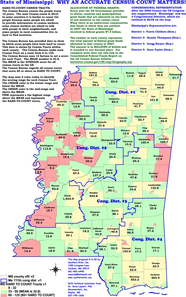
Click here for a selection of census maps related to various buy ativan cheap cities, counties and areas in the State of Mississippi.
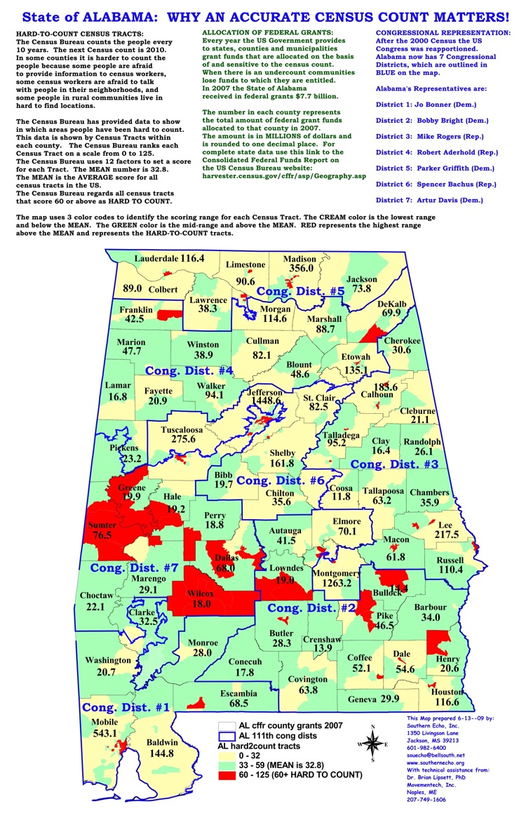
Click here for a selection of census maps related to various cities, counties and areas in the State of Alabama.
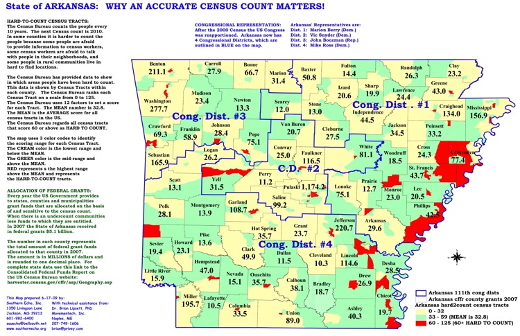
Click here for a selection of census maps related to various cities, counties and areas in the State of Arkansas.

Click here for a selection of census maps related to various cities, counties and areas in the State of California.
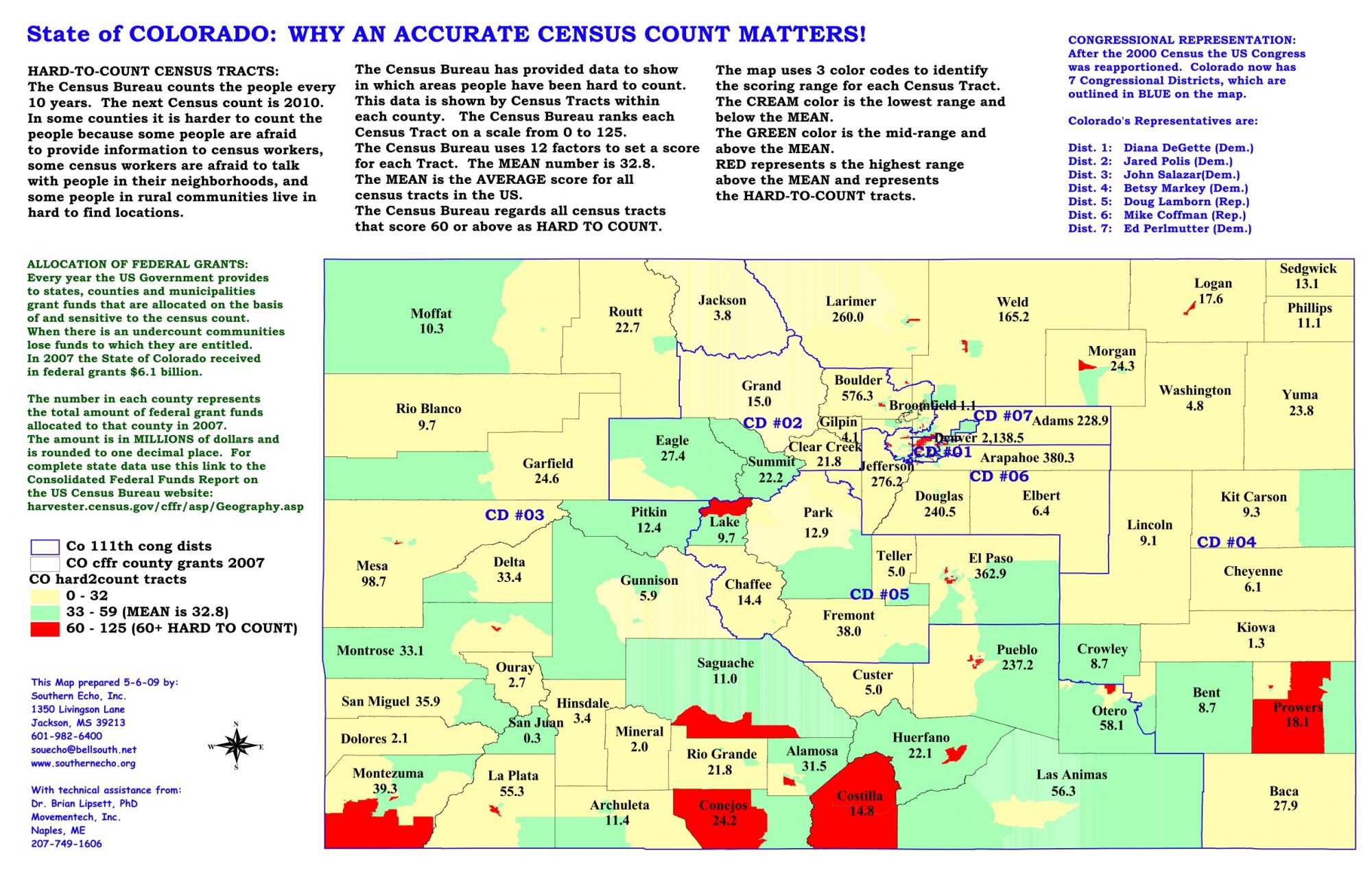
Click here for a selection of census maps related to various cities, counties and areas in the State of Colorado.

Click here for a selection of census maps related to various cities, counties and areas in the State of Georgia.
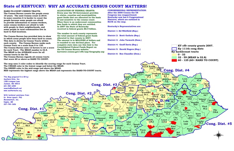
Click here for a selection of census maps related to various cities, counties and areas in the State of Kentucky.
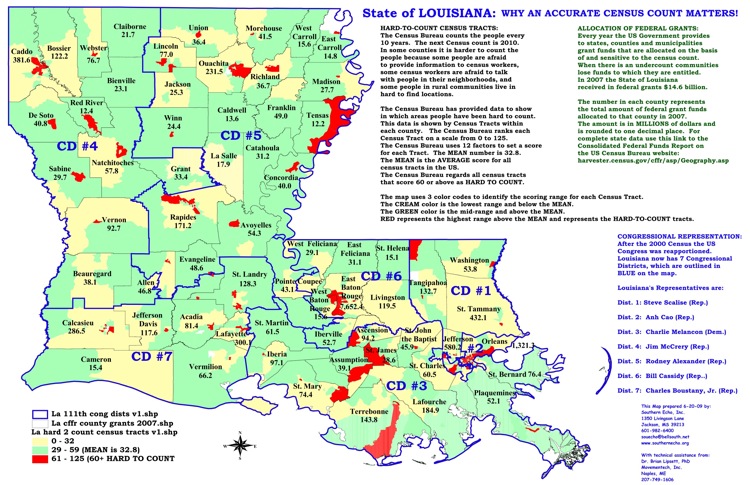
Click here for a selection of census maps related to various cities, counties and areas in the State of Louisiana.
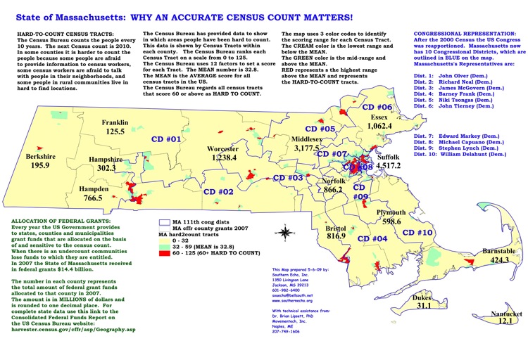
Click here for a selection of census maps related to various cities, counties and areas in the State of Massachusetts.
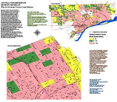
Click here for a selection of census maps related to various cities, counties and areas in the State of Michigan.
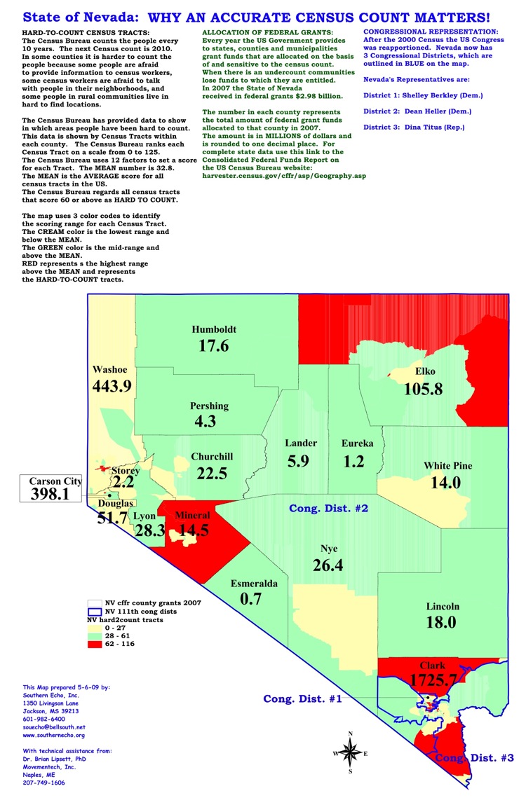
Click here for a selection of census maps related to various cities, counties and areas in the State of Nevada.
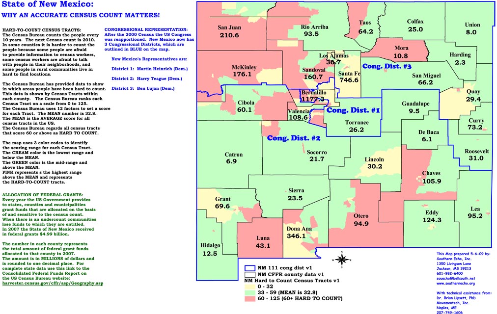
Click here for a selection of census maps related to various cities, counties and areas in the State of New Mexico.
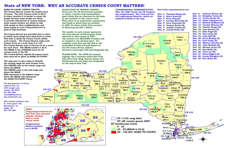
Click here for a selection of census maps related to various cities, counties and areas in the State of New York.
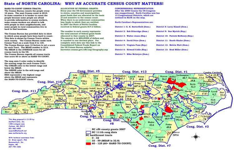
Click here for a selection of census maps related to various cities, counties and areas in the State of North Carolina.
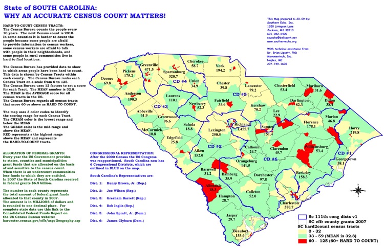
Click here for a selection of census maps related to various cities, counties and areas in the State of South Carolina.
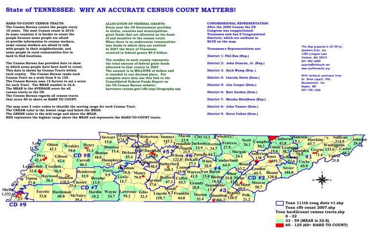
Click here for a selection of census maps related to various cities, counties and areas in the State of Tennessee.
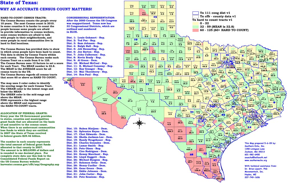
Click here for a selection of census maps related to various cities, counties and areas in the State of Texas.
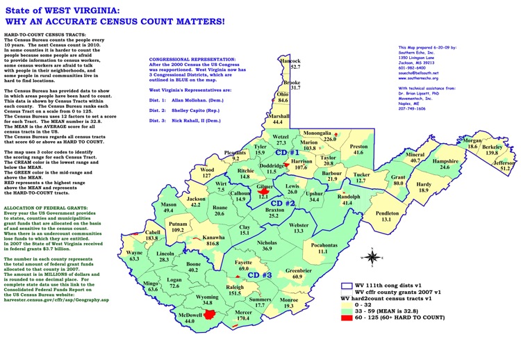
Click here for a selection of census maps related to various cities, counties and areas in the State of West Virginia.