- Holmes County, MS Hard to Count Census Tracts
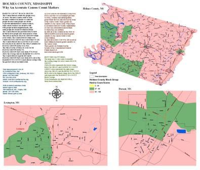
- Holmes County, MS Hard to Count Block Groups
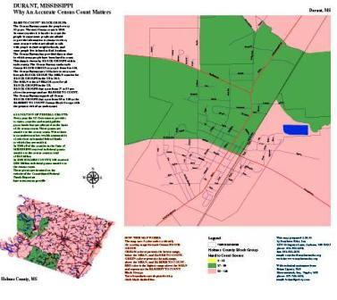
- Durant, MS Hard to County Block Groups
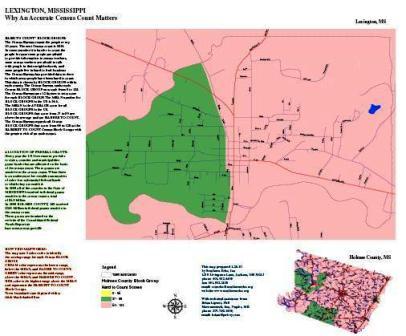
- Lexington, MS Hard to County Block Groups
- Cruger, MS Street Map with Population Data
- Durant, MS Street Map with Population Data
- Goodman, MS Street Map with Population Data
- Lexington, MS Street Map with Population Data
- West, MS Street Map with Population Data
Holmes County Census Map Descriptions
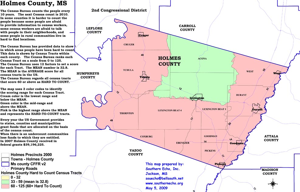 |
Holmes County, MS Hard to Count Census Tracts This Holmes County map shows the hard to count buy cheap 1mg xanax locations where it is more likely there will be a census undercount. An “undercount” means less federal grant funds for the county. The map also shows how many millions of dollars in federal grants the county received in 2007. |
 |
Holmes County, MS Hard to Count Block Groups This Holmes County map shows the hard to count locations where it is more likely there will be a census undercount. An “undercount” means less federal grant funds for the county. The map also shows how many millions of dollars in federal grants the county received in 2008. |
 |
Durant, MS Hard to County Block Groups This Town of Durant map shows the hard to count locations where it is more likely there will be a census undercount. An “undercount” means less federal grant funds for the county. The map also shows how many millions of dollars in federal grants the county received in 2008. |
 |
Lexington, MS Hard to County Block Groups This Town of Lexington map shows the hard to count locations where it is more likely there will be a census undercount. An “undercount” means less federal grant funds for the county. The map also shows how many millions of dollars in federal grants the county received in 2008. |
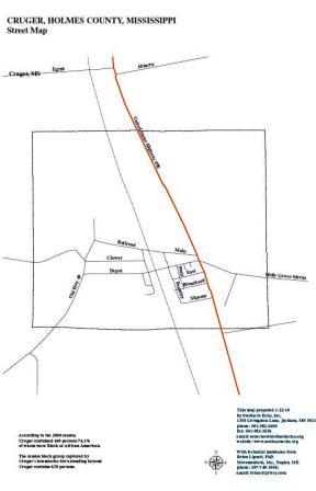 |
Cruger, MS Street Map with Population Data This street map outlines the streets of the town to facilitate the division of labor for community outreach volunteers working to maximize the census count to ensure everyone is counted. |
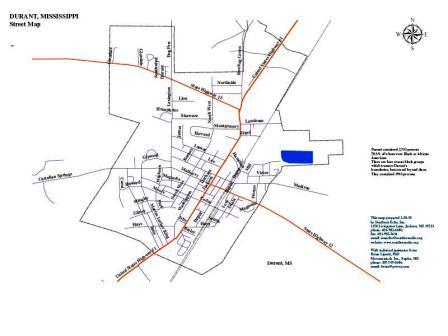 |
Durant, MS Street Map with Population Data This street map outlines the streets of the town to facilitate the division of labor for community outreach volunteers working to maximize the census count to ensure everyone is counted. |
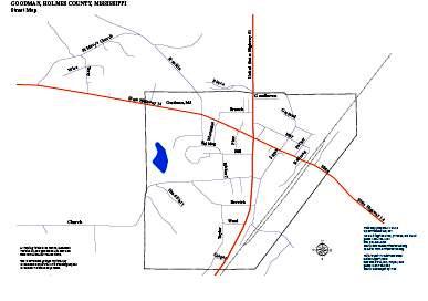 |
Goodman, MS Street Map with Population Data This street map outlines the streets of the town to facilitate the division of labor for community outreach volunteers working to maximize the census count to ensure everyone is counted. |
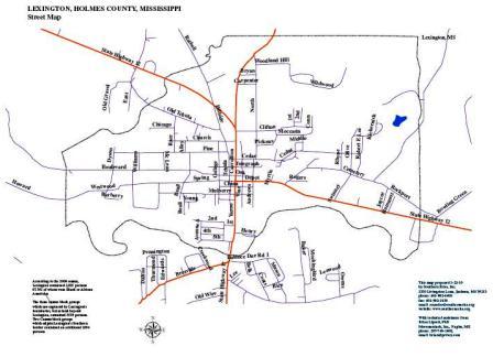 |
Lexington, MS Street Map with Population Data This street map outlines the streets of the town to facilitate the division of labor for community outreach volunteers working to maximize the census count to ensure everyone is counted. |
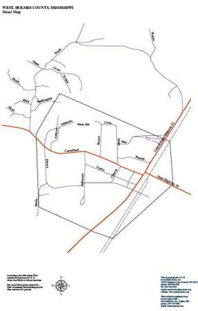 |
West, MS Street Map with Population Data This street map outlines the streets of the town to facilitate the division of labor for community outreach volunteers working to maximize the census count to ensure everyone is counted. |